
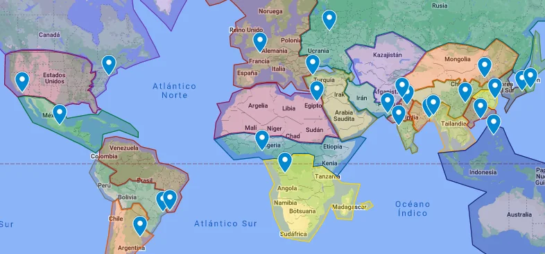
Have you ever noticed that postal codes look completely different depending on where you are in the world?
In the United States, you may see a five-digit ZIP Code such as 10001. In the United Kingdom, a postcode can contain both letters and numbers, such as SW1A 1AA. Canada uses a combination such as K1A 0B1, while Indonesia generally uses five-digit postal codes.
If postal codes all have the same basic purpose, why doesn’t the entire world use one universal format?
The answer is surprisingly interesting. Postal code systems developed at different times and were designed around each country’s geography, population, postal infrastructure, administrative structure, and delivery needs.
Let’s explore why postal codes vary from country to country and why these differences continue to matter today.
What Is a Postal Code?
A postal code is a group of numbers, letters, or both that helps identify a geographic area for mail delivery.
Depending on the country, it may be called a postal code, postcode, ZIP Code, PIN code, or another local term.
The basic purpose is the same: make it easier for postal services to sort, organize, and deliver mail.
A postal code may represent a large region, city, neighborhood, group of streets, or relatively small delivery area.
However, the way a country organizes these areas depends heavily on its own circumstances.
Postal Codes Were Developed at Different Times
One of the biggest reasons countries have different postal code systems is history.
Postal services did not create a worldwide addressing standard at the same time. Different countries introduced postal codes during different periods and for different reasons.
Some systems were developed when postal services began using mechanical or automated sorting equipment. Others evolved as cities became larger and mail volumes increased.
Because countries already had their own addressing conventions, postal code systems were often designed to fit existing infrastructure instead of replacing everything with a global standard.
This historical development explains why postal codes around the world are so diverse.
Geography Plays a Major Role
Geography is another important factor.
Consider the difference between a small densely populated country and a huge country with vast rural areas.
A country with millions of people concentrated in a relatively small area may need highly detailed postal codes to distinguish neighborhoods and streets.
Meanwhile, a country with large rural regions may design its system around towns, regions, or broader delivery areas.
Islands, mountains, deserts, remote communities, and large metropolitan areas can all influence how postal codes are organized.
Postal systems need to work with the physical geography of the countries they serve.
Population Density Changes Postal Code Requirements
Population density also influences postal code design.
Imagine two postal delivery areas.
The first contains 500 addresses spread across a large rural region.
The second contains 50,000 addresses in a densely populated urban neighborhood.
The second area requires much more detailed sorting information.
As cities grow, postal authorities may introduce more specific codes or reorganize existing postal districts.
This is one reason postal code systems can evolve over time.
Different Countries Have Different Addressing Traditions
Postal codes do not operate independently from addresses.
They are part of a larger addressing system that can include:
- House numbers
- Street names
- Neighborhoods
- Districts
- Cities
- States or provinces
- Regions
- Postal codes
- Country names
Different countries organize these elements differently.
For example, the way an address is written in Japan can be quite different from the way an address is written in the United States.
Because postal codes need to fit naturally into existing addressing systems, their formats vary as well.
Why Some Countries Use Numbers and Others Use Letters
Have you ever wondered why some postal codes contain only numbers while others contain letters?
The answer is largely related to how much information the system needs to represent.
A numeric system can provide a large number of combinations. Adding letters creates even more possible combinations while keeping the code relatively short.
For example, Canada uses an alphanumeric format:
A1A 1A1
The combination of letters and numbers allows the system to represent many delivery areas without requiring an excessively long code.
Other countries may find a numeric system perfectly adequate for their geographic and administrative needs.
The United States and ZIP Codes
The United States uses the term ZIP Code, which stands for Zone Improvement Plan.
The standard ZIP Code contains five digits.
For example:
90210
The system was introduced to improve mail sorting and delivery efficiency.
The United States also uses ZIP+4 codes for greater precision:
90210-1234
The additional digits can identify a more specific delivery segment.
The U.S. system demonstrates how a country can expand its postal code structure when more detailed geographic information becomes useful.
The United Kingdom and Postcodes
The United Kingdom has a different approach.
UK postcodes use letters and numbers and can be highly specific.
For example:
SW1A 1AA
A postcode can identify a relatively small delivery area and, in some cases, a limited group of addresses.
This level of detail is particularly useful in a densely populated country with a long-established postal network.
Canada’s Alphanumeric Postal Codes
Canada uses a combination of letters and numbers.
A typical Canadian postal code looks like:
M5V 3A8
The alphanumeric format provides many possible combinations while keeping the code relatively compact.
Canada’s geography also presents unique challenges because the country has enormous distances between some communities.
The postal system therefore needs to support major urban centers as well as remote and rural locations.
Indonesia’s Five-Digit Postal Codes
Indonesia generally uses five-digit postal codes, commonly known as kode pos.
For example:
10110
The system helps organize locations across Indonesia’s provinces, cities, regencies, districts, and villages.
Indonesia’s geography is particularly interesting because the country consists of thousands of islands.
A postal code system helps courier companies and postal services organize deliveries across a large and diverse geographic area.
Japan’s Seven-Digit Postal Codes
Japan generally uses seven-digit postal codes, usually displayed with a hyphen.
Example:
100-0001
Japan’s postal addressing system is closely connected to its administrative and geographic organization.
Postal codes help simplify the identification of areas even though Japanese addresses can contain several layers of geographic information.
Why There Is No Universal Postal Code
It might seem logical to create one global postal code system.
However, implementing such a system would be extremely complicated.
Every country would need to change existing databases, postal sorting equipment, government records, business systems, maps, shipping platforms, and countless online forms.
Billions of existing addresses would potentially need to be updated.
There would also be little practical benefit in forcing every country to use exactly the same format when their existing systems already work.
Instead, international shipping systems are designed to understand different national addressing standards.
Postal Codes and International Shipping
Different postal code formats are not necessarily a problem for international shipping.
Postal services and courier companies are accustomed to handling international addresses.
When a package crosses borders, different postal organizations can use the information in the complete address to route the shipment.
This is why it is important to include the destination country’s name when sending international mail.
A postal code by itself is not a universal location identifier.
Why Online Forms Can Be Confusing
One common problem occurs when an international website asks for a “ZIP Code.”
Someone outside the United States might wonder whether the website actually requires an American ZIP Code.
In many cases, the website is simply using “ZIP Code” as a generic label for a postal code.
This is why you may see fields labeled:
ZIP / Postal Code
or:
Postal / ZIP Code
The website is generally asking for the code used by your country’s postal system.
Postal Codes Can Change
Postal codes are not always permanent.
New neighborhoods may be developed, cities may expand, postal routes may change, and delivery networks may be reorganized.
A postal authority may introduce new codes or modify existing ones to improve efficiency.
This means an old address database may sometimes contain outdated postal information.
For important deliveries, it is best to verify the current postal code using a reliable source.
Technology Is Changing Postal Code Systems
Modern technology has also changed how postal codes are used.
Postal services now combine postal codes with:
- Digital maps
- GPS data
- Address databases
- Automated sorting machines
- Route optimization
- Geocoding
- E-commerce platforms
A postal code that was originally designed for sorting physical letters can now become useful data for businesses, logistics companies, mapping platforms, and online retailers.
The Future of Postal Codes
Will postal codes disappear someday?
Probably not in the near future.
Technology such as GPS and precise digital mapping can identify locations with incredible accuracy, but postal codes remain convenient for human-readable addresses.
They are simple to enter, easy to print, and already integrated into countless databases and delivery systems.
Instead of disappearing, postal codes are more likely to work alongside increasingly sophisticated digital location technologies.